

Up to the minute
Weather today
Temperature
-1 °C / 9 °C
Sunshine hours
6 h


Forecast
Weather forecast
DAILY WEATHER IN DETAIL
THE WEATHER TODAY
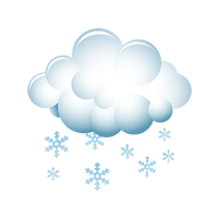
The latest weather models are indicating that the weather will be somewhat more changeable from the middle of the week onwards than recently. However, there is still no sign of bad weather until the weekend. On the contrary, Wednesday will also be mostly pleasant and quite sunny again. However, a slightly foehn-like southwesterly wind will bring us some unstable air in the mountains, so that clouds will repeatedly join the sun. This will happen at the front of an extremely weak cold front, which will cross us during the night on Thursday and may even bring light snowfall above 1500 meters above sea level. On Thursday itself, however, the weather will improve again during the day, and Friday will bring sunshine throughout. There will also be a slight foehn again. Another cold front is on the way. It will cross us on Saturday, and this time it will be stronger. In addition, the snow line will drop below 1000 meters above sea level. The following Sunday will see a temporary improvement.
Wetterstationen
LIVE REPORT
CURRENT TEMPERATUREs
ALL WEATHER STATIONS IN ISCHGL
table.scrollable
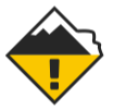
Avalanche warning
3 Considerable

The avalanche warning level refers to the Austrian part of the ski area
Avalanche warning
2 Moderate
The avalanche warning level refers to the Swiss part of the ski area
Up to the minute
The weather in Ischgl
Real-time information from your holiday region
Sunscreen, windbreaker or umbrella? To come perfectly prepared for your holiday adventure in the Paznaun valley, it’s a good idea to have a look at the weather forecast. Weather you’re headed for a ski resort or the region’s hiking trails – we have all the information you need for your upcoming trip.
Our forecasts keep you informed on things like the snow line, sunshine hours, rain probability and the daily maximum and minimum temperature. Plus, we’ll keep you up to date on the average wind speed and the current avalanche warning level.
Stay Tuned & Stay involved
What inspires – and what matters


