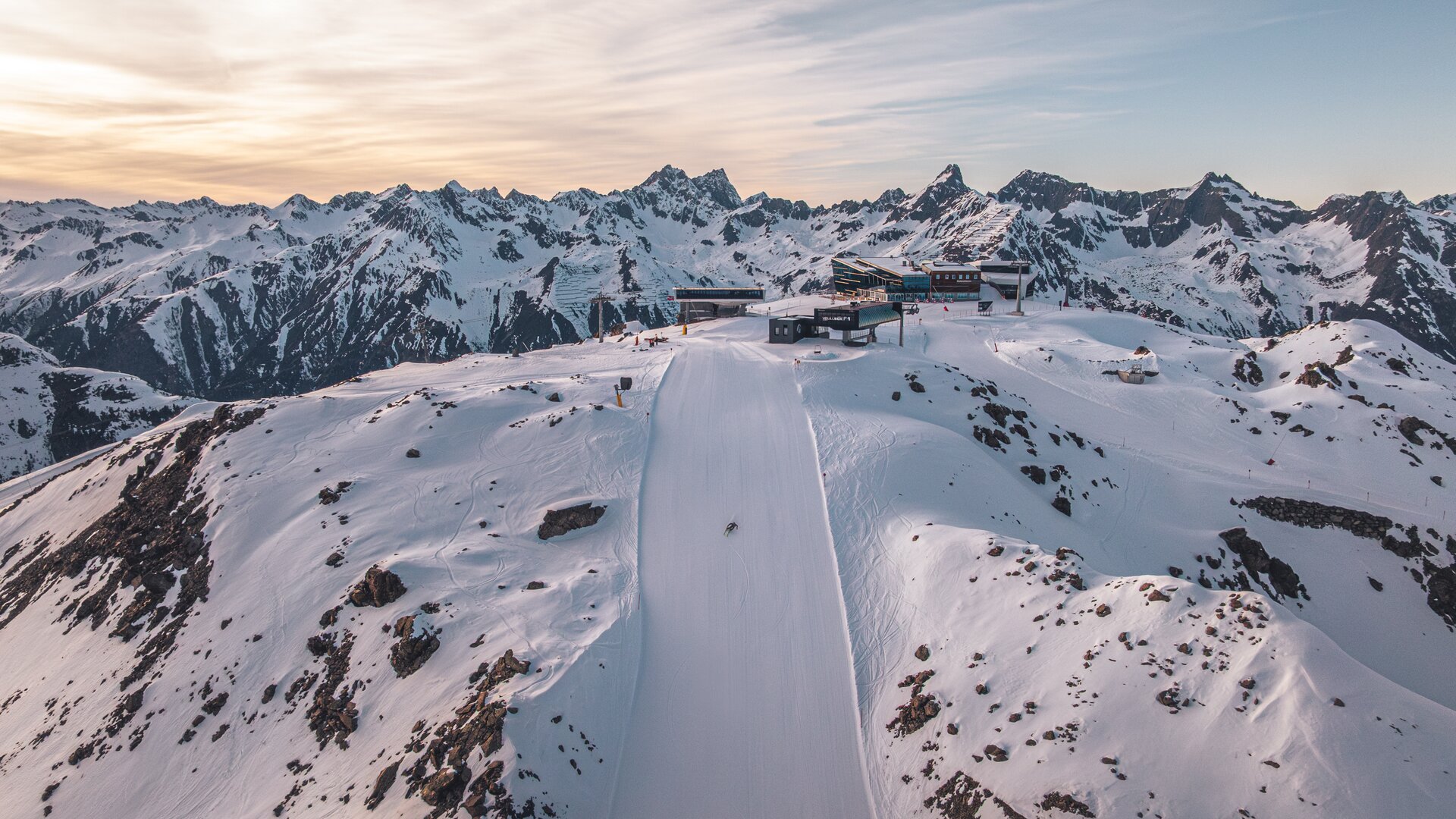
Slopes at the Silvretta Arena in Ischgl/Samnaun

27% Capacity ski area
Last update: *
Status Type Name Map
A1 Silvrettabahn
Status Type/Nr. Piste Details
M 1a valley run - Pardatschgrat
M 1 Idalp - middle station Silvrettabahn A1
M 1. middle station Silvrettabahn A1 - Ischgl
Journey time
11 min.
Speed
6 m/s
Drive capacity
2,810 kW
Year of construction
1998

The Silvrettabahn was constructed in summer 1998. It boasts a vertical rise of 961 m, a route distance of 3.938 mand a maximum capacity of up to 3.440 persons/hour. The middle station is located at 1.683 m above sea level. 1,4 Mio. guests per winter season use the facility.

Its 24-passenger bicable ropeway design (funitel system) facilitates safe operation even at wind speeds of 100 km/h. 63 gondolas run from Ischgl to Idalp with a maximum line speed of up to 6 m/s.

The transport system has a total of 23 pillars with a height of up to 23 m. 8 motors with a total capac i ty of 3.200 kW (4.350 PS) are required for the operation of the Silvrettabahn.

A2 Pardatschgratbahn
Status Type/Nr. Piste Details
M 1a valley run - Pardatschgrat
S 4 F1 mountain - middle station A2
M 5 Pardatschgrat Westabf. - middlestation A2
M 5a Pardatschgrat
Journey time
9.4 min.
Speed
7.5 m/s
Drive capacity
1,880 kW
Year of construction
2014

A3 Fimbabahn
Status Type/Nr. Piste Details
M 1 Idalp - middle station Silvrettabahn A1
M 1. middle station Silvrettabahn A1 - Ischgl
M 1a valley run - Pardatschgrat
Journey time
15.1 min.
Speed
5 m/s
Drive capacity
770 kW
Year of construction
2007

B1 Velillbahn
Status Type/Nr. Piste Details
M 7 Velilltal - Velilleckbahn valley
E 8 Velillbahn mountain - Idalp
Journey time
4.9 min.
Speed
5 m/s
Drive capacity
470 kW
Year of construction
1995

B10 Förderband Viderböden
Status Type/Nr. Piste Details
E 2 Idalp - Höllboden
E 11 Idjoch - Idalp
Journey time
1.5 min.
Speed
0.9 m/s
Drive capacity
11 kW
Year of construction
2011

B2 Flimjochbahn
Status Type/Nr. Piste Details
S 9 Flimjoch Mountain - Idalp
M 10 Flimjoch - Idalp
E 11 Idjoch - Idalp
Journey time
6.5 min.
Speed
5 m/s
Drive capacity
612 kW
Year of construction
2016

The detachable chair lift departs at 2,302 m above sea level (Idalp) and runs over 16 pillars to the Viderjoch, located at 2,756 m altitude. In winter, this facility is mainly used to support the Idjoch 8-person chair lift. The 87 chairs are equipped with comfortable seat covers, seat heating and weather protection bubbles. The facility has a total capacity of 3,200 m persons per hour. The Flimjochbahn operates from the mountain station, has a vertical rise of 454 m and a route distance of 1,797 m. Built in 2016, this lift facility boasts an average of 1,2 Mio. trips per winter season.

B3 Idjochbahn
Status Type/Nr. Piste Details
E 11 Idjoch - Idalp
M 12 Idjoch - Höllboden
Journey time
6 min.
Speed
5 m/s
Drive capacity
745 kW
Year of construction
2001

B4 Greitspitzlift
Status Type/Nr. Piste Details
S 13 start piste eleven
M 14 Greitspitze - Idjoch
Journey time
3.5 min.
Speed
2.6 m/s
Drive capacity
75 kW
Year of construction
1980

B5 Sonnenbahn
Status Type/Nr. Piste Details
E 6 Pardatschgrat - Idalp
Journey time
2.8 min.
Speed
5 m/s
Drive capacity
197 kW
Year of construction
2011

B6 Übungslift Velill
Status Type/Nr. Piste Details
E 6 Pardatschgrat - Idalp
Journey time
2.5 min.
Speed
2.5 m/s
Drive capacity
16 kW
Year of construction
1995

B7 Übungslift Viderböden
Status Type/Nr. Piste Details
E 11 Idjoch - Idalp
Journey time
1.3 min.
Speed
2.5 m/s
Drive capacity
12 kW
Year of construction
1996

B8 Gratbahn
Status Type/Nr. Piste Details
E 6 Pardatschgrat - Idalp
Journey time
3.2 min.
Speed
5 m/s
Drive capacity
420 kW
Year of construction
2002

B9 Förderband Übungsareal
Status Type/Nr. Piste Details
E 6 Pardatschgrat - Idalp
Journey time
1.5 min.
Speed
0.9 m/s
Drive capacity
11 kW
Year of construction
2011

C1 Höllbodenbahn
Status Type/Nr. Piste Details
E 2 Idalp - Höllboden
Journey time
3.4 min.
Speed
4.5 m/s
Drive capacity
410 kW
Year of construction
2000

C2 Höllkarbahn
Status Type/Nr. Piste Details
E 23 Palinkopf valley - Höllboden
M 24 Höllkarbahn mountain - Höllkarbahn valley
Journey time
5.5 min.
Speed
5 m/s
Drive capacity
560 kW
Year of construction
1998

C3 Sassgalunbahn
Status Type/Nr. Piste Details
M 25 Sassgalun - Höllboden
Journey time
3.5 min.
Speed
1.8 m/s
Drive capacity
160 kW
Year of construction
1997

C4 Nachtweidebahn
Status Type/Nr. Piste Details
M 2a Idalp - Nachtweide valley
E 2b ideal for beginners
Journey time
6.1 min.
Speed
4.5 m/s
Drive capacity
470 kW
Year of construction
2004

C5 Lange Wandbahn
Status Type/Nr. Piste Details
S 13 start piste eleven
S 14a Greitspitz - Höllkar
S 14b Greitspitze - Höllkar
S 14c Greitspitze - Höllkar
S 15 Greitspitze - Höllkar
Journey time
5.6 min.
Speed
5 m/s
Drive capacity
624 kW
Year of construction
2010

D1 Palinkopfbahn
Status Type/Nr. Piste Details
S 20 Palinkopf - Palinkopfbahn valley
S 21 Zeblasbahn mountain- Zeblasbahn valley
E 22 Palinkopf - Palinkopfbahn valley
S 33 Palinkopf - Paznauner Thaya
Journey time
5.8 min.
Speed
5 m/s
Drive capacity
576 kW
Year of construction
2017

D2 Zeblasbahn
Status Type/Nr. Piste Details
S 20 Palinkopf - Palinkopfbahn valley
S 21 Zeblasbahn mountain- Zeblasbahn valley
E 22 Palinkopf - Palinkopfbahn valley
S 33 Palinkopf - Paznauner Thaya
Journey time
4.9 min.
Speed
5 m/s
Drive capacity
510 kW
Year of construction
2000

E1 Paznauner Thayabahn
Status Type/Nr. Piste Details
M 30 Sassgalun - Paznauner Thaya
M 31 Sassgalun - Paznauner Thaya
Journey time
4.2 min.
Speed
5 m/s
Drive capacity
385 kW
Year of construction
2003

E2 Höllspitzbahn
Status Type/Nr. Piste Details
M 32 Höllspitz - Restaurant Schwarzwand
S 34 Höllspitz - Paznauner Thaya
S 35 Höllspitz - Paznauner Thaya
Journey time
6 min.
Speed
5 m/s
Drive capacity
620 kW
Year of construction
1994

E3 Bodenalpbahn
Status Type/Nr. Piste Details
M 36 Paznauner Thaya - Bodenalp
M 37 Bodenalpbahn mountain - A3 middle station
Journey time
5 min.
Speed
2.4 m/s
Drive capacity
190 kW
Year of construction
2000

E4 Gampenbahn
Status Type/Nr. Piste Details
S 39 Palinkopf - Gampenalp
M 40 Palinkopf - Gampenalp
S 40a Gampenalp
M 40a Palinkopf - Gampenalp
E 40b Gampenbahn valley - Bodenalpe
M 40c Gampenalp
S 41 Palinkopf - Piz Val Gronda Tal
S 41. Palinkopf - Piz Val Gronda Tal
Journey time
7.87 min.
Speed
5.5 m/s
Drive capacity
1,041 kW
Year of construction
2018

E5 Piz Val Grondabahn
Status Type/Nr. Piste Details
S 41 Palinkopf - Piz Val Gronda Tal
M 42 Piz Val Gronda Bergstation - Piz Val Gronda Talstation
Journey time
5.4 min.
Speed
12 m/s
Drive capacity
620 kW
Year of construction
2013

F1 Velilleckbahn
Status Type/Nr. Piste Details
S 4 F1 mountain - middle station A2
S 4a Velilleckbahn mountain - Velilleckbahn valley
M 7 Velilltal - Velilleckbahn valley
S 7a Velilleckbahn valley - Pardatschgrat valley
S 7a. Velill valley
Journey time
5.9 min.
Speed
6 m/s
Drive capacity
661 kW
Year of construction
2019

F2 Pardoramabahn
Status Type/Nr. Piste Details
S 4 F1 mountain - middle station A2
M 5 Pardatschgrat Westabf. - middlestation A2
M 5a Pardatschgrat
Journey time
5.4 min.
Speed
5 m/s
Drive capacity
617 kW
Year of construction
1990

G2 Schwarzwasserlift
Status Type/Nr. Piste Details
M 37 Bodenalpbahn mountain - A3 middle station
Journey time
4.5 min.
Speed
2.5 m/s
Drive capacity
19 kW
Year of construction
1999

L1 Double-decker aerial tramway
Journey time
5.7 min.
Speed
10 m/s
Drive capacity
1,250 kW
Year of construction
1995

The Twinliner in Samnaun is one of the largest aerial cable cars in the Alps, featuring two double-decker gondolas with a total capacity of 180 passengers, with 110 passengers traveling in the upper and 70 passengers traveling in the lower gondola. The cableway runs with a max. ground clearance of 210 m over 3 pillars from Samnaun to Alp Trider Sattel. Built in 1995, the aerial cableway has a vertical rise of 722 m, a route distance of 2.300 m and a total capacity of 1.620 persons/hour. Maximum speed is 10 m/s, rope diameter is 64mm.

L2 Luftseilbahn
Journey time
6 min.
Speed
10 m/s
Drive capacity
686 kW
Year of construction
1978

M1 Grivaleabahn
Status Type/Nr. Piste Details
M 61 Grivaleabahn valley - Samnaun Compatsch
M 76 Grivaleabahn mountain - Gravaleabahn valley
Journey time
5.3 min.
Speed
4.8 m/s
Drive capacity
432 kW
Year of construction
1996

M2 Mullerbahn
Status Type/Nr. Piste Details
M 61 Grivaleabahn valley - Samnaun Compatsch
M 68 Muller mountain - Muller valley
M 68a Muller mountain - Muller valley
M 68b Muller mountain station - Alp Trida
Journey time
3 min.
Speed
5 m/s
Drive capacity
335 kW
Year of construction
2010

N1 Flimsattelbahn
Status Type/Nr. Piste Details
E 62 Viderjoch - Alp Trida
M 62a Viderjoch - Alp Trida
Journey time
9 min.
Speed
5 m/s
Drive capacity
577 kW
Year of construction
1994

The Flimsattelbahn has a vertical rise of 490 m and a route distance of 2.727 m. It departs from the base station (2.265 m) and runs over 29 pillars up to an altitude of 2.755 m. The 186 chairs are equipped with weather protection bubbles. Constructed in 1994, this facility has a total capacity of 2.400 passengers/hour. 1,1 Mio. guests per winter season use this facility mainly on their way back to Idalp from Alp Trida. The rope has a diameter of 45mm.
 

N2 Visnitzbahn
Status Type/Nr. Piste Details
M 65 Visnitzbahn mountain - Alp Trida
M 65a Visnitzbahn mountain - Alp Trida
M 67 Mullerbahn mountain - Alp Trida
Journey time
4.5 min.
Speed
5 m/s
Drive capacity
600 kW
Year of construction
2019

N3 Milolift (Übungslift)
Status Type/Nr. Piste Details
E 69 Alp Trida Eck - Alp Trida
Journey time
1.8 min.
Speed
2.5 m/s
Drive capacity
11 kW
Year of construction
1985

N4 Viderjochbahn 1
Status Type/Nr. Piste Details
E 63 Idjoch - Alp Trida
Journey time
5.2 min.
Speed
5 m/s
Drive capacity
522 kW
Year of construction
2003

N6 Alp Trider Sattelbahn
Status Type/Nr. Piste Details
E 69 Alp Trida Eck - Alp Trida
M 69b Alp Trida Eck - Alp Trida
Journey time
3.4 min.
Speed
5 m/s
Drive capacity
318 kW
Year of construction
2000

Built in 2000, the detachable chair lift has weather protection bubbles, a total capacity of 2.800 persons per hour and 60 six-person chairs, which travel 1.050 m over 10 pillars up to the mountain station.

N7 Alp Trida Förderband
Journey time
1 min.
Speed
0.6 m/s
Drive capacity
3 kW
Year of construction
2003

O1 Greitspitzbahn
Status Type/Nr. Piste Details
E 64 Idjoch - Alp Trida Eck
M 70 Greitspitze - Salaas
M 70a Greitspitze - Alp Trida Eck
S 72 Greitspitze - 72a
M 72a Idjoch - Alp Trida Eck
Journey time
4.7 min.
Speed
5 m/s
Drive capacity
598 kW
Year of construction
1998

O2 Blais Grondalift
Status Type/Nr. Piste Details
E 71 Viderjochbahn mountain - Alp Trida Eck
Journey time
3.6 min.
Speed
3.1 m/s
Drive capacity
87 kW
Year of construction
1980

O4 Viderjochbahn 2
Status Type/Nr. Piste Details
E 64 Idjoch - Alp Trida Eck
M 72a Idjoch - Alp Trida Eck
Journey time
4.3 min.
Speed
5 m/s
Drive capacity
503 kW
Year of construction
2004

P1 Musellalift
Journey time
2.6 min.
Speed
2.5 m/s
Drive capacity
60 kW
Year of construction
1984

P2 Förderband Musella 1
Journey time
1 min.
Speed
0.6 m/s
Drive capacity
6 kW
Year of construction
2012

P3 Förderband Musella 2
Journey time
1 min.
Speed
0.7 m/s
Drive capacity
6 kW
Year of construction
2012

G1 Übungslift Mathon
Journey time
2.7 min.
Speed
2.5 m/s
Drive capacity
45 kW
Year of construction
2009

N5 Alp Trider Ecklift
Status Type/Nr. Piste Details
E 69 Alp Trida Eck - Alp Trida
E 69a Alp Trida Eck - Alp Trida
Journey time
3.9 min.
Speed
2.5 m/s
Drive capacity
49 kW
Year of construction
1991

Last update: *
Status Type snow-making facilities Name Details
E
Musella
M 1
Idalp - middle station Silvrettabahn A1
M 1.
middle station Silvrettabahn A1 - Ischgl
M 10
Flimjoch - Idalp
E 11
Idjoch - Idalp
M 12
Idjoch - Höllboden
S 13
start piste eleven
M 13.
Greitspitze - Idalp
M 14
Greitspitze - Idjoch
S 14a
Greitspitz - Höllkar
S 14b
Greitspitze - Höllkar
S 14c
Greitspitze - Höllkar
S 15
Greitspitze - Höllkar
M 1a
valley run - Pardatschgrat
E 2
Idalp - Höllboden
S 20
Palinkopf - Palinkopfbahn valley
S 21
Zeblasbahn mountain- Zeblasbahn valley
E 22
Palinkopf - Palinkopfbahn valley
E 23
Palinkopf valley - Höllboden
M 24
Höllkarbahn mountain - Höllkarbahn valley
M 25
Sassgalun - Höllboden
S 26
Höllkar
M 2a
Idalp - Nachtweide valley
E 2b
ideal for beginners
M 3
Idalp - middle station Fimba
M 30
Sassgalun - Paznauner Thaya
M 31
Sassgalun - Paznauner Thaya
M 32
Höllspitz - Restaurant Schwarzwand
S 33
Palinkopf - Paznauner Thaya
S 34
Höllspitz - Paznauner Thaya
S 35
Höllspitz - Paznauner Thaya
M 36
Paznauner Thaya - Bodenalp
M 37
Bodenalpbahn mountain - A3 middle station
M 38
Höllspitzbahn mountain - Gampen
S 39
Palinkopf - Gampenalp
S 4
F1 mountain - middle station A2
M 40
Palinkopf - Gampenalp
M 40a
Palinkopf - Gampenalp
E 40b
Gampenbahn valley - Bodenalpe
M 40c
Gampenalp
S 41
Palinkopf - Piz Val Gronda Tal
S 41.
Palinkopf - Piz Val Gronda Tal
M 42
Piz Val Gronda Bergstation - Piz Val Gronda Talstation
S 42.
Val Gronda mountain- Val Gronda valley
S 4a
Velilleckbahn mountain - Velilleckbahn valley
M 5
Pardatschgrat Westabf. - middlestation A2
M 5a
Pardatschgrat
E 6
Pardatschgrat - Idalp
E 60
Alp Trida - Samnaun Compatsch
E 62
Viderjoch - Alp Trida
M 62a
Viderjoch - Alp Trida
E 63
Idjoch - Alp Trida
E 64
Idjoch - Alp Trida Eck
M 65
Visnitzbahn mountain - Alp Trida
M 65a
Visnitzbahn mountain - Alp Trida
M 66
Visnitzbahn mountain - Mullerbahn mountain
M 67
Mullerbahn mountain - Alp Trida
M 68
Muller mountain - Muller valley
M 68a
Muller mountain - Muller valley
M 68b
Muller mountain station - Alp Trida
E 69
Alp Trida Eck - Alp Trida
E 69a
Alp Trida Eck - Alp Trida
M 69b
Alp Trida Eck - Alp Trida
S 6a
Pardatschgrat - Velill
M 7
Velilltal - Velilleckbahn valley
M 70
Greitspitze - Salaas
M 70a
Greitspitze - Alp Trida Eck
E 71
Viderjochbahn mountain - Alp Trida Eck
S 72
Greitspitze - 72a
M 72a
Idjoch - Alp Trida Eck
M 76
Grivaleabahn mountain - Gravaleabahn valley
S 7a
Velilleckbahn valley - Pardatschgrat valley
E 8
Velillbahn mountain - Idalp
M 80
piste to samnaun village
E 80a
Samnaun valley – valley station Ravaisch
E 80b
Samnaun Dorf – Talstation Ravaisch
S 81
Zeblasbahn mountain - Samnaun
S 9
Flimjoch Mountain - Idalp
E
Mathon
S 12a
Idjoch - Höllkar
S 26a
Höllkar
S 3a
Idalp - middle station A3
S 40a
Gampenalp
M 61
Grivaleabahn valley - Samnaun Compatsch
S 7a.
Velill valley
Last update: *
Status Nr. Name Map
a Sattel
Sattel
restaurant
b Alp Trida
Alp Trida
restaurant

2.270 m

  • Table service: La Marmotte
  • Self-service
  • Pizza
  • Après-ski bar
  • Kiosk
c Skihaus Alp Trida
Skihaus Alp Trida
restaurant

2.250 m

  • Table service
  • Self-service
  • Schnitzel events
d Alp Bella
Alp Bella
restaurant

2.380 m

  • Table service
  • Self-service
  • Chicken grill
  • Sun terrace
e Salaas
Salaas
restaurant

2.456 m

  • Table service
  • Self-service
  • Lounge bar
  • Sun roof terrace with champagne bar
f Idalp - Panorama
Idalp - Panorama
restaurant

2.320 m

Self-service restaurant
ith an ice bar, large sun terrace and guest kindergarten for children aged 2 and over.

PANORAMA table service restaurant
Treat yourself to some delicious Austrian cuisine in the rustic lounges or on our sun terrace. We also offer a selection of craft beers
and exquisite wines. 

g Alpenhaus
Alpenhaus
restaurant

2.300 m

Self-service area with traditional cuisine, wood grill area, serviced bar and terrace.
Table service restaurant on the first floor with lounge and terrace.

h Pardorama
Pardorama
restaurant

2.624 m

The restaurant with probably the most beautiful views in the ski resort. Enjoy lots of national and international
dishes and our self-service and table service restaurant.

i Höllboden
Höllboden
restaurant

2.141 m

We offer lots of national dishes at our self-service restaurant. You can also enjoy a hearty plate of bacon or, by prior arrangement, a fondue in our table service lounge.

j Vider Alp
Vider Alp
restaurant

2.250 m

  • Table service
  • Ski hut
  • Ice bar
k Schwarzwand
Schwarzwand
restaurant

2.468 m

Our self-service restaurant is an insider tip for pizza lovers. And for everyone else, there are the classics such as Viennese schnitzel, giant yeast dumplings etc.

l Paznauner Taja
Paznauner Taja
restaurant

2.000 m

  • Table service
  • Self-service
  • Sun terrace
  • Ice bar
m Bodenalp
Bodenalp
restaurant

1.840 m

  • Table service
n Ischgl Slope Food
Ischgl Slope Food
restaurant

1.924 m

We can recommend our self-service restaurant right by the Gampenbahn E4 valley station for a quick bite to eat on-thego. How about a burger?

o Gampenalpe
Gampenalpe
restaurant

1.990 m

Enjoy Tyrolean cuisine at our Gampenalpe. The table service restaurant is situated on ski piste 40.

p Heidelberger Hütte
Heidelberger Hütte
restaurant

2.264 m

Last update: *
Status Type Name Map
Ischgl Snowpark
Ischgl Snowpark
bordercrosspark/funpark
Ischgl Snowpark - Funline
bordercrosspark/funpark
Snowcross Alp Trider Sattel
bordercrosspark/funpark
BRONZE smuggler’s circuit

The Smuggler’s Run Bronze is for ski and snowboarders who prefer easy (blue) slopes. It is the shortest and easiest of the 3 new ski runs. The new ski run takes you from the Austrian side of the border into Switzerland.

The best viewpoints are at Palinkopf (2,864 m), Pardatschgrat (2,624 m) and the Alp Trida saddle (2,488 m). The smugglers round bronze leads to the duty free paradise Samnaun.

SILVER smuggler’s circuit

The Smuggler’s Run Silver is a challenging ski route that includes black and red runs in the Silvretta Arena. The new ski run takes you from the Austrian side of the border into Switzerland.
The best viewpoints are at Palinkopf (2,864 m) and on Muller (2,509 m). The Smuggler’s Run Silver takes you via piste no. 80 directly to the village of Samnaun, where you can find many duty free shops.

GOLD smuggler’s circuit

The Smuggler’s Run Gold is one of the longest and most challenging ski runs in the world.
The new ski run takes you from the Austrian side of the border into Switzerland.

The best viewpoints are at Palinkopf (2,864 m), Piz Val Gronda (2,812 m) and on Muller (2,509 m). The Smuggler’s Run Gold takes you via piste no. 80 directly to the village of Samnaun, where you can find many duty free shops.

Schlittelpiste
Schlittelpiste
toboggan run
S1 Schlittelbahn Samnaun Dorf (unterer Teil, 0.5 km)
toboggan run
Alpenquell indoor pool Samnaun
swimming pool
Silvretta Thermea
Silvretta Thermea
swimming pool

Silvretta spa – the highlights

  • 5 storeys with indoor and outdoor areas
  • 1,000 m² water surface
  • 300 m² heated outdoor pool on the roof terrace
  • 1,500 m² sauna area
  • 300 m² lounge area
  • 320 m² gym
  • event facilities for up to 600 people
  • 1,300 m² ice rink


Speed run
Speed run
speed course (measurement of speed)
Obstacle Park Samnaun
bordercrosspark/funpark
Ischgl Skyfly (Tue–Sun 11am–6pm)

The new Ischgl SkyFly offers daredevils an opportunity to zip wire 50 m above the ground into valley in the direction of Ischgl.

Thrill seekers will hit breathtaking speeds of up to 84 km/h on the 2 km long ride. Two parallel wires run from the middle station Sivrettabahn A1 (1,683 m) via two intermediate stations to the roof terrace of the valley station of 3-S Pardatschgratbahn A3 (1,376 m). This means that two people can "fly" together into the valley. On the second spectacular stretch of the new attraction, zip wire enthusiasts can fly under the Kitzloch suspension bridge and through the Fimbabahn. Adrenaline rush guaranteed.

Night sledding Ischgl
toboggan run

Mid-December to start of April
Monday and Thursday in good weather and snow conditions


  • Ascent: Silvrettabahn from 07.00 p.m. - 08.30 p.m.
  • Altitude difference: 950 m
  • Length: 7 km (illuminated)
  • Live music at the Restaurant Idalp
S1 Schlittelbahn Samnaun Dorf
toboggan run
Eislaufplatz Clis da Ravaisch Samnaun
ice-skating
Ice rink Silvretta Therme
ice-skating

The ice rink is located on the 1st floor of the Silvretta Therme.

  • L3, Wald Loipe

    • open: 5 km
    • m medium
    • Map

    Those looking for something more challenging are in good hands at the forest trail.

    At a length of 5 km with over 130 m difference of altitude you can go to your limits.

    Starting point
    Galtür Tschaffein
    Endpoint
    Galtür Tschaffein
    Route length
    5 km
    Currently open
    5 km
    Overall increase
    135 hm
    Difficulty
    medium
    Status
    open
    Style
    classic or skating
    career opportunities
    Galtür Tschaffein, Mathon Wildpark
    Connection trail
    L2, L4
    Refreshments
    Restaurants in Galtür/Mathon
  • L4, Tschaffein Loipe

    • open: 3.3 km
    • e easy
    • Map

    Perfect views to the Gorfen- & Ballunspitze, the local mountains in Galtür are included.

    The short Tschaffein trail with only 3,3 km length is perfect for your first tries on the trail and is not too demanding with an altitude difference of 50 metres.

    Starting point
    Galtür centre
    Endpoint
    Galtür centre
    Route length
    3.3 km
    Currently open
    3.3 km
    Overall increase
    50 hm
    Difficulty
    easy
    Status
    open
    Style
    classic or skating
    career opportunities
    Galtür centre, Galtür Tschaffein
    Connection trail
    L5, L3
    Refreshments
    Restaurants in Galtür
  • L5, Galtür – Wirl Loipe

    • open: 6.5 km
    • m medium
    • Map

    Experience cross-country skiing in Galtür, the highest place in Paznaun at close to 1,600 m elevation, protected by the massive mountains of the Silvretta massif.

    Galtür’s motto is “Experience alpine wintersports!” The Galtür Wirl Trail, at 6,5 km and minor elevation requires only medium stamina and coordination and is also suited for intermediate skiers.

    Starting point
    Galtür centre
    Endpoint
    Galtür centre
    Route length
    6.5 km
    Currently open
    6.5 km
    Overall increase
    110 hm
    Difficulty
    medium
    Status
    open
    Style
    classic or skating
    career opportunities
    Galtür Wirl
    Connection trail
    L4, R1a, R2
    Refreshments
    Restaurants in Galtür & Wirl
  • L6, FIS Rennloipe Galtür 3.7

    • open: 3.7 km
    • m medium

    classic partly groomed

    classic partly groomed
    Starting point
    Intersport Wolfart (main shop)
    Endpoint
    Intersport Wolfart (main shop)
    Route length
    3.7 km
    Currently open
    3.7 km
    Overall increase
    92 hm
    Difficulty
    medium
    Status
    open
    Style
    skating
    career opportunities
    Galtür
    Refreshments
    Restaurants in Galtür
  • L6.1, FIS-Sprintloipe Galtür 1.3

    • open: 1.3 km
    • m medium

    classic partly groomed

    classic partly groomed
    Starting point
    Intersport Wolfart (main shop)
    Endpoint
    Intersport Wolfart (main shop)
    Route length
    1.3 km
    Currently open
    1.3 km
    Overall increase
    44 hm
    Difficulty
    medium
    Status
    open
    Style
    skating
    career opportunities
    Galtür
    Refreshments
    Restaurants in Galtür
  • L6.2, FIS Panoramaloipe Galtür 2.5

    • open: 2.5 km
    • m medium

    classic partly groomed

    classic partly groomed
    Starting point
    Intersport Wolfart (main shop)
    Endpoint
    Intersport Wolfart (main shop)
    Route length
    2.5 km
    Currently open
    2.5 km
    Overall increase
    53 hm
    Difficulty
    medium
    Status
    open
    Style
    skating
    career opportunities
    Galtür
    Refreshments
    Restaurants in Galtür
  • L6.3, FIS Guggermühlloipe Galtür 3.3

    • open: 3.3 km
    • m medium

    classic partly groomed

    classic partly groomed
    Starting point
    Intersport Wolfart (main shop)
    Endpoint
    Intersport Wolfart (main shop)
    Route length
    3.3 km
    Currently open
    3.3 km
    Overall increase
    70 hm
    Difficulty
    medium
    Status
    open
    Style
    skating
    career opportunities
    Galtür
    Refreshments
    Restaurants in Galtür
  • R2, Zeinis – Kops Route

    • open: 11.5 km
    • C Cross-country-skiing route
    • Map

    The area surrounding the Zeinissee and Kops reservoir are certainly among the most idyllic places in Paznaun.

    At the border between Tyrol and Vorarlberg, a magnificent view of giant peaks of the Silvretta massif awaits you.

    Starting point
    Galtür Wirl
    Endpoint
    Galtür Wirl
    Route length
    11.5 km
    Currently open
    11.5 km
    Overall increase
    255 hm
    Difficulty
    Cross-country-skiing route
    Status
    open
    Style
    classic or skating
    career opportunities
    Zeinis - Kops
    Connection trail
    R1, L5
    Refreshments
    Restaurants in Wirl
  • S-B 1, Dammloipe

    • open: 2 km
    • e easy

    This cross-country skiing route starts directly at the dam (to the left of the Piz Buin mountain inn).

    In the beginning, the route runs slightly downhill and then slightly uphill, but afterwards it is always nice and flat along the dam of the Silvretta reservoir.

    Starting point
    Silvretta Bielerhöhe
    Endpoint
    Silvretta Bielerhöhe
    Route length
    2 km
    Currently open
    2 km
    Overall increase
    82 hm
    Difficulty
    easy
    Status
    open
    Style
    Classic and skating
    career opportunities
    Silvretta Bielerhöhe
    Connection trail
    R1b
    Refreshments
    Berggasthof Piz Buin, Madlenerhaus, Silvretta-Haus
  • S-B 2, Silvretta Höhenloipe, klein / small

    • open: 1 km
    • e easy

    The Silvretta-Höhenloipe is a circular tour. It starts at the Piz Buin mountain inn and leads past the Barbara Chapel in the direction of Lake Vermunt.

    After about 1 km, you'll pass the Silvrettahaus and finally end up at the Piz Buin inn.

    Starting point
    Berggasthof Piz Buin
    Endpoint
    Berggasthof Piz Buin
    Route length
    1 km
    Currently open
    1 km
    Overall increase
    13 hm
    Difficulty
    easy
    Status
    open
    Style
    Classic and skating
    career opportunities
    Silvretta Bielerhöhe
    Connection trail
    R1b
    Refreshments
    Berggasthof Piz Buin, Madlenerhaus, Silvretta-Haus
  • S-B 3, Silvretta Höhenloipe, mittel / medium

    • open: 2 km
    • m medium

    The Silvretta-Höhenloipe is a circular tour. It starts at the Piz Buin mountain inn and leads past the Barbara Chapel in the direction of Lake Vermunt.

    After about 2 km, you'll pass the Silvrettahaus and finally end up at the Piz Buin inn.

    Starting point
    Berggasthof Piz Buin
    Endpoint
    Berggasthof Piz Buin
    Route length
    2 km
    Currently open
    2 km
    Overall increase
    53 hm
    Difficulty
    medium
    Status
    open
    Style
    Classic and skating
    career opportunities
    Silvretta Bielerhöhe
    Connection trail
    R1b
    Refreshments
    Berggasthof Piz Buin, Madlenerhaus, Silvretta-Haus
  • S-B 4, Silvretta Höhenloipe, groß / large

    • open: 4 km
    • m medium

    The Silvretta-Höhenloipe is a circular tour. It starts at the Piz Buin mountain inn and leads past the Barbara Chapel in the direction of Lake Vermunt.

    After about 1 km, you'll pass the Silvrettahaus and finally end up at the Piz Buin inn.

    Starting point
    Berggasthof Piz Buin
    Endpoint
    Berggasthof Piz Buin
    Route length
    4 km
    Currently open
    4 km
    Overall increase
    61 hm
    Difficulty
    medium
    Status
    open
    Style
    Classic and skating
    career opportunities
    Silvretta Bielerhöhe
    Connection trail
    R1b
    Refreshments
    Berggasthof Piz Buin, Madlenerhaus, Silvretta-Haus
  • S-B 5, Madlenerhaus-Loipe, klein / small

    • open: 1 km
    • e easy
    Route length
    1 km
    Currently open
    1 km
    Overall increase
    12 hm
    Difficulty
    easy
    Status
    open
    Refreshments
    Berggasthof Piz Buin, Madlenerhaus, Silvretta-Haus
  • S-B 6, Madlenerhaus-Loipe, mittel / medium

    • open: 1 km
    • e easy
    Route length
    1 km
    Currently open
    1 km
    Overall increase
    20 hm
    Difficulty
    easy
    Status
    open
    Refreshments
    Berggasthof Piz Buin, Madlenerhaus, Silvretta-Haus
  • S-B 7, Madlenerhaus-Loipe, groß / large

    • open: 2 km
    • e easy
    Route length
    2 km
    Currently open
    2 km
    Overall increase
    21 hm
    Difficulty
    easy
    Status
    open
    Refreshments
    Berggasthof Piz Buin, Madlenerhaus, Silvretta-Haus
  • Samnaun L1 , Samnaun – Dorf – Ravaisch

    • open: 1.6 km
    • m medium
    Route length
    1.6 km
    Currently open
    1.6 km
    Overall increase
    51 hm
    Difficulty
    medium
    Status
    open
  • Samnaun L2, Samnaun-Plan – Samnaun-Laret

    • open: 2 km
    • e easy
    Route length
    2 km
    Currently open
    2 km
    Overall increase
    23 hm
    Difficulty
    easy
    Status
    open
  • R1a, Route Vermunt 1: Baggerloch

    • in preparation
    • R cross-country route
    • Map

    Vermunt route 1 „The flooded gravel pit“ starts direct in Wirl and proceeds to the first half of the Kleinvermunt, up to the flooded gravel pit.

    The breath-taking scenery and the mountains covered in deep snow in this unspoilt lateral valley are what make this route so special.

    Starting point
    Galtür Wirl
    Endpoint
    Galtür Wirl
    Route length
    9.7 km
    Currently open
    0 km
    Overall increase
    146 hm
    Difficulty
    cross-country route
    Status
    in preparation
    Style
    classic or skating
    career opportunities
    Galtür Wirl
    Connection trail
    R1b, R2, L5
    Refreshments
    Restaurants in Wirl
  • R1b, Route Vermunt 2: Bielerhöhe

    • in preparation
    • C Cross-country-skiing route
    • Map

    Vermunt route 2 „Bielerhöhe“ connects directly to Vermunt route 1 „flooded gravel pit“ - proceed to the highest point of this slope network at 2039m.

    This cross-country route is challenging, yet the dreamy panoramic mountain views will help you forget almost all of those efforts, since on the sun-blessed Bielerhöhe, with the impressive Silvretta reservoir, enjoyment comes easy.

    Starting point
    Vermunt Baggerloch
    Endpoint
    Vermunt Baggerloch
    Route length
    9.3 km
    Currently open
    0 km
    Overall increase
    255 hm
    Difficulty
    Cross-country-skiing route
    Status
    in preparation
    Style
    classic or skating
    career opportunities
    Vermunt Baggerloch (via Route R1a Vermunt 1), Bielerhöhe
    Connection trail
    R1a, Slopes at Bielerhöhe
    Refreshments
    Restaurant Piz Buin
  • L1, Ischgl Loipe

    The Ischgl trail is ideal for a first-time cross-country skiing exploration tour, or for quiet winter holidays.

    With 5 km and a very flat trail profile, it is not overtly challenging, yet still rewards you with a feeling of accomplishment.

    Starting point
    Ischgl Silvretta parking lot
    Endpoint
    Ischgl Silvretta parking lot
    Route length
    5 km
    Currently open
    0 km
    Overall increase
    40 hm
    Difficulty
    easy
    Status
    closed
    Style
    classic or skating
    career opportunities
    Ischgl village, Hamlet Paznaun, Recycling area Ischgl
    Connection trail
    L2
    Refreshments
    Restaurants in Ischgl
  • L2, Mathon Loipe

    With a length of 5,5 km, the Mathon trail leads through the snowy countryside, with romantic clearings and past the Mathon natural park.

    You’ll experience Paznaun in its most pristine form.

    Starting point
    Mathon
    Endpoint
    Mathon
    Route length
    5.5 km
    Currently open
    0 km
    Overall increase
    60 hm
    Difficulty
    easy
    Status
    closed
    Style
    classic or skating
    career opportunities
    Mathon, Wild park, Recycling area Ischgl
    Connection trail
    L1, L3
    Refreshments
    Restaurants in Mathon
Last update: *
  • Ischgl – Ebene

    • open: 8.5 km
    • e easy

    This leisurely winter hiking trail leads from the Silvretta cable car along the valley trail towards Kappl.

    After the Silvretta parking lot, cross a small bridge and follow the signs for "Winterwanderweg Ebene". Shortly after, cross the rushing Madlein stream and the districts of Versahl, Vergröß, Platt and finally Ebene follow. On this path, slightly above the Trisanna, you can escape the hustle and bustle of the lifestyle metropolis and enjoy the snow-covered scenery. In the hamlet of Ebene, there is a bus stop allowing you an easy return trip back to Ischgl. Those who still have some energy can hike back along the same route.

    Starting point
    Ischgl Silvretta parking lot
    Endpoint
    Ischgl Ebene
    Route length
    8.5 km
    Currently open
    8.5 km
    Walking time
    2 h
    Difficulty
    easy
    Status
    open
    Refreshments
    Inns along the way
  • Ischgl – Mutta

    • open: 6 km
    • e easy

    The winter hiking trail up to the Mutta leads from Ischgl village centre through forests covered in deep snow uphill in switchbacks.

    From up here you have wonderful views across all of Ischgl and can observe the lively goings-on at a distance. The wide path winds uphill for 2.5 km, rewarding those getting to the top with great views. From the Silvretta cable car, walk past the parking lot and after crossing the bridge follow the signs for Mutta. On the way back, the route can be extended a bit and some sunshine caught by not walking back in direction of the parking lot again after Jungmann Inn, but taking the turn-off before and hiking to the hamlet of Paznaun. A few benches beckon to put in a rest, offering fine views of Ischgl town centre. From the hamlet of Paznaun, it's back to the village again.

    Starting point
    Ischgl Silvretta cable car
    Endpoint
    Ischgl Silvretta cable car
    Route length
    6 km
    Currently open
    6 km
    Walking time
    1.5 h
    Difficulty
    easy
    Status
    open
    Refreshments
    Inns in Ischgl
  • Ischgl

    • open: 5 km
    • e easy

    The Ischgl winter hiking trail is perfect as an initial explorative tour or something for more leisurely days when on winter holidays.

    With 5 km of level routing, it is not overly demanding yet leaves you with the feeling of actually having done something. The hiking trail starts right by the Silvretta parking lot and is marked with a sign (entry point to cross-country skiing trail). In the beginning, a short walk leads directly along the cross-country skiing trail before the route branches off onto a separate trail in the hamlet of Paznaun. The trail continues across level terrain for 2.5 km in direction of Mathon. Having arrived at the recycling yard, the following options are available: either take the same trail back (total length of hike 5 km) or take the bus back to Ischgl or continue hiking towards Galtür, where you can get on the Mathon winter hiking trail.

    Starting point
    Ischgl Silvretta parking lot
    Endpoint
    Ischgl recycling yard
    Route length
    5 km
    Currently open
    5 km
    Walking time
    1.5 h
    Difficulty
    easy
    Status
    open
    Refreshments
    Inns in Ischgl
  • Ischgl – Mathon

    • open: 6 km
    • e easy

    This 6 km long winter hiking trail can be combined with the winter hiking trail from Ischgl. Alternatively, take the bus to the entry point.

    The route immediately starts off with a short climb, but then levels out again and continues on the gallery and then close to the forest to Mathon. When exiting the village, cross the Valzur stream and walk to the wildlife park located below. Here you can stop off at the inn or take a bus for the return trip. Alternatively, hike along the now opposite side of Trisanna stream back to Ischgl. The route proceeds almost exclusively level along the banks back to the starting point. Of course, the route can also be hiked in the opposite direction.

    Starting point
    Ischgl recycling yard
    Endpoint
    Wildlife park Mathon
    Route length
    6 km
    Currently open
    6 km
    Walking time
    1.5 h
    Difficulty
    easy
    Status
    open
    Refreshments
    Inns in Ischgl
  • Ischgl – Panoramatour Verwall

    • open: 12 km
    • m medium

    The starting point ‘Friedrichshafener Hut' car park is located in the Valzur area between Ischgl and Galtür and is accessible either by car or by bus (Piel bus stop – then walk a short section out of the valley).

    The route proceeds upwards, in lots of switchbacks, but is never too steep - you cover some 500 meters to reach your destination. A fantastic viewing point beneath Friedrichshafener Hut (closed in the winter), with views to the impressive mountains in the Silvretta and Samnaun groups. Return via the same route.

    Starting point
    Parking lot Friedrichshafener Lodge
    Endpoint
    Parking lot Friedrichshafener Lodge
    Route length
    12 km
    Currently open
    12 km
    Walking time
    4 h
    Difficulty
    medium
    Status
    open
    Refreshments
    none
  • Schmugglertour – Ischgl – Samnaun

    • open
    • n not specified

    If you want to combine a cross-border hiking trip with shopping, the Smugglers' Tour to duty-free Samnaun is just the thing for you.

    This tour can be adapted to your fitness level. You can decide by yourself whether you want to do the entire route by cable car and chairlift, or put in some sections of hiking. An experience of the special kind. From Ischgl village centre, either take the Fimba (A3) - or Silvretta cable car (A1) up to the Idalp at 2,300 m. Then take the Flimjoch chairlift (B2) to the Viderjoch hiking area at 2,700 m, which forms the border between Austria and Switzerland. Next take the Flimsattel chairlift (N1) to get to the Alp Trida Restaurant on Swiss soil. After a few metres on foot you'll reach the lower terminus of the chairlift "Alp Trider Sattelbahn" (N6). From up there, the double-deck aerial tramway (L1 or L2) goes back to Samnaun, where numerous shops are waiting to be explored. Please note: Begin return trip in Samnaun no later than 14:30, to make sure you can get back to Ischgl by lift all the way.

    Starting point
    Ischgl Silvretta cable car
    Endpoint
    Ischgl Silvretta cable car
    Difficulty
    not specified
    Status
    open
    Refreshments
    Restaurants in the Ischgl – Samnaun ski area
  • ST1, Samnaun Dorf – Motnaida

    • open: 1.3 km
    • e easy
    Starting point
    Samnaun Dorf beim Motnaida
    Endpoint
    Samnaun Dorf beim Motnaida
    Route length
    1.3 km
    Currently open
    1.3 km
    Walking time
    0.5 h
    Difficulty
    easy
    Status
    open
  • ST2, Samnaun-Ravaisch – Samnaun-Laret

    • open: 1.9 km
    • e easy
    Route length
    1.9 km
    Currently open
    1.9 km
    Walking time
    0.5 h
    Difficulty
    easy
    Status
    open
  • TW, Samnaun – Talwanderweg Samnaun-Laret – Samnaun Dorf

    • open: 3.4 km
    • e easy
    Route length
    3.4 km
    Currently open
    3.4 km
    Walking time
    1 h
    Difficulty
    easy
    Status
    open
  • W1, Samnaun-Compatsch – Mottas Lungas

    • open: 3.7 km
    • e easy
    Route length
    3.7 km
    Currently open
    3.7 km
    Walking time
    1.05 h
    Difficulty
    easy
    Status
    open
  • W10, Samnaun – Skihaus Alp Trida – Alp Bella

    • open: 3.7 km
    • m medium
    Route length
    3.7 km
    Currently open
    3.7 km
    Walking time
    1.1 h
    Difficulty
    medium
    Status
    open
  • W2, Samnaun-Compatsch – Tschoccas

    • open: 3.5 km
    • m medium
    Route length
    3.5 km
    Currently open
    3.5 km
    Walking time
    1.14 h
    Difficulty
    medium
    Status
    open
  • W3, Samnaun-Laret – Samnaun-Ravaisch

    • open: 3.4 km
    • e easy
    Route length
    3.4 km
    Currently open
    3.4 km
    Walking time
    1.04 h
    Difficulty
    easy
    Status
    open
  • W3, Samnaun-Ravaisch – Samnaun Dorf

    • open
    Status
    open
  • W4, Samnaun-Plan – Tschischanaderet

    • open: 3.4 km
    • m medium
    Route length
    3.4 km
    Currently open
    3.4 km
    Walking time
    1.1 h
    Difficulty
    medium
    Status
    open
  • W5, Samnaun-Ravaisch – Foppaziner-Eck

    • open: 2.7 km
    • m medium
    Route length
    2.7 km
    Currently open
    2.7 km
    Walking time
    1.01 h
    Difficulty
    medium
    Status
    open
  • W6, Samnaun Dorf – Val Motnaida (unterer Teil 0.5 km)

    • open
    Route length
    0.5 km
    Currently open
    0 km
    Walking time
    0.5 h
    Status
    open
  • W7, Samnaun Dorf Votlas – Clis da Ravaisch

    • open: 0.7 km
    • e easy
    Route length
    0.7 km
    Currently open
    0.7 km
    Walking time
    0.13 h
    Difficulty
    easy
    Status
    open
  • W9, Samnaun – Alp Trider Sattel – Salaas

    • open: 3 km
    • e easy
    Route length
    3 km
    Currently open
    3 km
    Walking time
    0.55 h
    Difficulty
    easy
    Status
    open
  • W6, Samnaun Dorf – Motta Saltuorn – Val Motnaida

    • closed
    • m medium
    Route length
    3 km
    Currently open
    3 km
    Walking time
    2.21 h
    Difficulty
    medium
    Status
    closed
  • W8, Samnaun Dorf – Rundwanderweg Pragrond (Märchenweg)

    • closed
    • e easy
    Route length
    2.6 km
    Currently open
    2.6 km
    Walking time
    0.4 h
    Difficulty
    easy
    Status
    closed
  • ​Snowshoe hike in Dias

    • open
    • m medium

    This winter hiking trail starts in the Kappl ski area. Take the Diasbahn lift for a leisurely ride up to 1,830 m, and then hike via the hamlet of Oberhaus back to Kappl. 

    The first section leads downhill along the piste, before getting onto the toboggan run. Through the snow-covered forest you'll get to the lower terminus of the Gongall twin-seater chairlift after a while. From here, take the forest path towards Oberhaus and hike along the municipal road through the hamlets of Stadlen, Hof, Obermühl, Grubegg and Larchi all the way down to the village. Of course, this route can also be hiked in the opposite direction.

    Starting point
    Mountain station Diasbahn cable car
    Endpoint
    Mountain station Diasbahn cable ca
    Route length
    1.8 km
    Currently open
    0 km
    Walking time
    1 h
    Difficulty
    medium
    Status
    open
    Refreshments
    Sunny Mountain Restaurant, Bock-Alm
  • Galtür - Panorama-Rundwanderweg Silvapark

    • open: 1 km
    • e easy

    Easy winter hiking trail directly in the ski area

    Even winter hikers get their money's worth in the Galtür Silvapark ski area. The Alpkogel cable car takes you comfortably to the mountain station - then it's a 5-minute walk to the Silvapark winter hiking trail.

    Starting point
    Alpkogelbahn Galtür Wirl
    Endpoint
    Alpkogelbahn Galtür Wirl
    Route length
    1 km
    Currently open
    1 km
    Walking time
    0.5 h
    Difficulty
    easy
    Status
    open
    Refreshments
    Faulbrunn Alm
  • Galtür – Menta

    • open: 2.9 km
    • e easy

    The Menta winter hiking trail starts in the district of Gaffelar and runs in a southern direction into Jamtal Valley.

    Here you have unmatched views of Jamtal glacier already at the start of the entrance to the valley. After some 1.5 km you'll get to the end of this winter hiking trail and the way back also leads along the same route. Please note that the Menta Alm is closed in the winter.

    Starting point
    Galtür hamlet Gaffelar
    Endpoint
    Galtür hamlet Gaffelar
    Route length
    2.9 km
    Currently open
    2.9 km
    Walking time
    1.5 h
    Difficulty
    easy
    Status
    open
    Refreshments
    Inns in Galtür
  • Galtür – Panoramatour Verwall

    • open: 12 km
    • m medium

    The starting point ‘Friedrichshafener Hut' car park is located in the Valzur area between Ischgl and Galtür and is accessible either by car or by bus (Piel bus stop – then walk a short section out of the valley).

    The route proceeds upwards, in lots of switchbacks, but is never too steep - you cover some 500 meters to reach your destination. A fantastic viewing point beneath Friedrichshafener Hut (closed in the winter), with views to the impressive mountains in the Silvretta and Samnaun groups. Return via the same route.

    Starting point
    Parking lot Friedrichshafener Lodge
    Endpoint
    Parking lot Friedrichshafener Lodge
    Route length
    12 km
    Currently open
    12 km
    Walking time
    4 h
    Difficulty
    medium
    Status
    open
    Refreshments
    none
  • Galtür – Silvapark

    • open: 3 km
    • e easy

    After a short journey on the Alpkogelbahn you reach the starting point of the Silvapark winter hiking trail.

    Linger for a while in one of the loungers to take in a view which will take your breath away. Follow the signposted trail into the valley. The hike passes the Faulbrunnalm and Fluchthornalm mountain restaurants. Enjoy the wonderful sunshine on the terraces at the mountain restaurants and indulge in some delicious Tyrolean food. After a lovely hike through the SILVAPARK ski area you reach the hamlet of Oberwirl. From here you still have the opportunity to take the winter hiking trail which proceeds to Galtür. 

    Note: Walks on the hiking trail are carried out at your risk. Skiers/snowboarders use the entire area, so watch out for them, particularly when crossing the pistes.

    Starting point
    Alpkogelbahn Galtür Wirl
    Endpoint
    Galtür Wirl
    Route length
    3 km
    Currently open
    3 km
    Walking time
    1.5 h
    Difficulty
    easy
    Status
    open
    Refreshments
    restaurants in the ski area and in Wirl
  • Galtür – Tschaffein – Waldkapelle

    • open: 9 km
    • m medium

    The hike starts at the football pitch in Galtür, first walking along the Trisanna stream over level terrain to the hamlet of Tschaffein.

    From there, take the footway to the "Rifugio" holiday homes and then a short bit along the A-road, before continuing left back onto the steamrolled winter hiking trail. Above the road, hike through the woodland until walking down to the wildlife park along Valzurbach stream. After a short climb, continue along level terrain through the forest until getting to the romantically located forest chapel, and then the hamlet of Tschaffein, before arriving back in Galtür again. The entire circuit of a total of 9 km (from and back to Galtür) does require some fitness - but any effort is soon forgotten when taking in the views of the mighty Ballunspitze (2,671 m) rising up from Galtür. Those who think this is too far can shorten the circuit by hiking only to the wildlife park and taking a bus back to Galtür from there.

    Starting point
    Galtür village square
    Endpoint
    Galtür village square
    Route length
    9 km
    Currently open
    9 km
    Walking time
    2.5 h
    Difficulty
    medium
    Status
    open
    Refreshments
    Inns in Galtür
  • Galtür – Wirl

    • open: 4 km
    • m medium

    The winter hiking trail between Galtür and Wirl requires medium strong fitness with its 4 km and gentle climbs. Start off at the Galtür football.

    The trail leads across flat terrain along the Vermunt stream and into the valley, until you get to Wirl district and the lower terminus of the Birkhahnbahn cable car. Experience the snow-covered scenery in Galtür, the highest located township in Paznaun, at just below 1,600 m and sheltered by the soaring mountains of the Silvretta Group. Numerous 3,000-metre peaks are within touching distance here and the scenery is shaped by the prominent peaks. Galtür means "Experiencing high alpine winter sports!" This tour is especially recommendable on Wednesday evenings when the lights of the night-time skiing light up the Silvapark.

    Starting point
    Galtür village square
    Endpoint
    Galtür Wirl
    Route length
    4 km
    Currently open
    4 km
    Walking time
    1.5 h
    Difficulty
    medium
    Status
    open
    Refreshments
    Inns in Galtür and Wirl
  • Galtür – Zeinis – Kops

    • open: 11.5 km
    • d difficult

    The area around the Zeinis & Kops reservoirs is surely one of the most idyllic spots in Paznaun.

    By the border between Tirol & Vorarlberg, impressive views of the sheltering giants of the Silvretta group await. The route starts in Wirl district opposite the St. Antonius chapel – just before Hotel Wirlerhof. Past the alpine farm, a steady climb on the old Zeinisstraße leads towards Zeinis or Kops. The last bit before the two lakes is level again. First you'll get to the smaller Zeinis reservoir, then Kops reservoir. An impressive backdrop for all winter sports fans opens up here! Please note that no rest stops with food or drink are available up here. A total of 11.5 km is to be negotiated on this route. No short-cut by bus is possible.

    Starting point
    Galtür Wirl
    Endpoint
    Galtür Wirl
    Route length
    11.5 km
    Currently open
    11.5 km
    Walking time
    3 h
    Difficulty
    difficult
    Status
    open
    Refreshments
    Inns in Galtür and Wirl
  • Kappl – Mittelschule – Dorf

    • open: 4.5 km
    • m medium

    The hike starts in the hamlet of Lochau, where the new secondary school is located.

    This winter hiking trail leads through snowy forest, across romantic clearings, past a wildlife feeding station to the shooting club. Here the peacefulness can be optimally enjoyed while relaxing at ease. About 500 metres after the shooting club, switch to the other side of the road. Then keep left and after some 100 metres take the route in direction of Platti. On the sealed road, continue via Untermühl back to Kappl village centre. All in all, a leisurely circuit which is not too demanding.

    Starting point
    Secondary school in Kappl
    Endpoint
    Kappl Village
    Route length
    4.5 km
    Currently open
    4.5 km
    Walking time
    1.5 h
    Difficulty
    medium
    Status
    open
    Refreshments
    Inns in Kappl
  • Kappl – Mittelschule – Nederle

    • open
    • e easy

    Those looking for a leisurely winter hiking trail which is not too demanding are right on target here. 

    The level trail from Paznaun secondary school to Nederle is ideal for a leisurely walk through the Kappl winter scenery. From the secondary school in the hamlet of Lochau, keep heading into the valley along Trisanna stream until passing the Kappl cable cars. Then walk through the districts of Höferau, Sinsner Au to finally reach the hamlet of Nederle after Hotel Höllroah. Getting back to Kappl village is easy by bus. Those who want can also hike back the same way.

    Starting point
    Secondary school in Kappl
    Endpoint
    Kappl Nederle
    Route length
    3.5 km
    Currently open
    0 km
    Walking time
    1.5 h
    Difficulty
    easy
    Status
    open
    Refreshments
    Inns in Kappl
  • Kappl – Rotwegkapelle

    • open
    • m medium

    The winter hiking trail from Kappl village to the Rotweg chapel may be somewhat more challenging due to its climbs, 

    but in turn provides breath-taking views of lower Paznaun valley. It starts off at Kappl village square. Below the church, hike in direction of Hotel Dorfstadl to the Diasbahn turn-off. A meadow path leads to the left down to the Diasbahn lower terminus. Here you cross the road across Kohlplatz bridge, from where the forest path to Rotweg chapel begins. Somewhat steep to begin with, the hike leads through snowy winter scenery until getting to the small chapel, from where you have nice views of the village and various hamlets. When a thick blanket of snow has fallen onto the roof of Rotweg chapel and the sun makes the snow sparkle, that's when winter is showing its best side.

    Starting point
    Kappl Village
    Endpoint
    Kappl Village
    Route length
    4 km
    Currently open
    0 km
    Walking time
    2 h
    Difficulty
    medium
    Status
    open
    Refreshments
    Inns in Kappl
  • Kappl – See

    • open: 8.5 km
    • e easy

    Nowhere else can the beauty of winter be better enjoyed than on a walk through the snow.


    Enjoy the peacefulness of nature on a walk along the winter hiking trail from Kappl to See. The trail starts at Kappl church and initially leads along the municipal road through the hamlets of Schmiedsegg, Untermühl and Platti. Continue heading out of the valley, repeatedly alternating between forest roads and sealed sections after the Holdernach turn-off. Pass the districts of Holdernach, Sesselebene and Schnatzerau, until finally getting to the finish at the See cable car. The route is very varied and you'll get to see the individual – in part very original - hamlets along the way. If you want to hike just one section, you can get back from See to Kappl easily.

    Starting point
    Kappl Village
    Endpoint
    See Cable Car
    Route length
    8.5 km
    Currently open
    8.5 km
    Walking time
    2.5 h
    Difficulty
    easy
    Status
    open
    Refreshments
    Inns in Kappl and See
  • Kappl – Sesslad

    • open: 3.5 km
    • e easy

    A leisurely trail, also suitable for families or those who prefer shorter jaunts, is the Sunny Mountain winter hiking trail in the Kappl ski area.

    Hover up to 1,830 meters on the Diasbahn lift, where the trail starts. Through the tunnel (above the upper terminus) you’ll get to the Sunny Mountain Restaurant. From here, a path to the left (above the Sunny Mountain Restaurants) leads all the way to where the children’s practice area is. Here, follow the groomed path below the new pump station along the dam of the “new reservoir” until after about a ½-hour walk you’ll get to the and of the path (way back along the same route). All in all, a peaceful and leisurely tour for those who like to take things a little slower. Those who like can put in a short walk along the border of the lake of the upper reservoir first. This short detour from the hike proper is well worth the effort, as benches provide a chance to put in a well-deserved break.

    Starting point
    Mountain station Diasbahn cable car
    Endpoint
    Mountain station Diasbahn cable car
    Route length
    3.5 km
    Currently open
    3.5 km
    Walking time
    1.5 h
    Difficulty
    easy
    Status
    open
    Refreshments
    Inns in the ski area
  • Kappl – über Oberhaus

    • open: 6 km
    • e easy

    This winter hiking trail starts in the Kappl ski area. Take the Diasbahn lift for a leisurely ride up to 1,830 m, and then hike via the hamlet of Oberhaus back to Kappl. 

    The first section leads downhill along the piste, before getting onto the toboggan run. Through the snow-covered forest you'll get to the lower terminus of the Gongall twin-seater chairlift after a while. From here, take the forest path towards Oberhaus and hike along the municipal road through the hamlets of Stadlen, Hof, Obermühl, Grubegg and Larchi all the way down to the village. Of course, this route can also be hiked in the opposite direction.

    Starting point
    Mountain station Diasbahn cable car
    Endpoint
    Kappl Village
    Route length
    6 km
    Currently open
    6 km
    Walking time
    2 h
    Difficulty
    easy
    Status
    open
    Refreshments
    Inns in Kappl
  • See Gratli – Ascherhütte

    • open: 3 km
    • m medium
    • Map

    The winter hike to Ascherhütte is a great alternative to skiing.

    Take Medrigjochbahn cable car and Zeinisbahn chairlift to get to the starting point. The scenic tour starts at Zeinisbahn mountain station. A marked trail will take you along ski run No. 32 all the way to Furglerblick valley station. From there, continue along ski run No. 30 until you reach Ascherhütte. At the top, you will be rewarded with splendid views of the Verwall mountains and Hoher Riffler (3,168 metres). To get back to the starting point of your tour, simply follow the same trail back and hop on the cable car back to See.

    Starting point
    Zeinisbahn mountain station
    Endpoint
    Ascherhütte and back to Zeinisbahn mountain station
    Route length
    3 km
    Currently open
    3 km
    Walking time
    1.5 h
    Difficulty
    medium
    Status
    open
    Refreshments
    Panoramarestaurant, Restaurant Gratli and Ascherhütte
  • See Medrig – Versing

    • open: 5.5 km
    • m medium
    • Map

    This tour to Versing Alm gives you 5.5 kilometres of pure winter hiking bliss.

    Nature lovers will enjoy the quiet surroundings of this trail. The tour starts with a conveyor belt taking you to the ski resort’s practice area for beginners. From there, a marked trail runs along the practice area and ski run No. 30, taking you all the way to Versingbahn valley station. The final part of the tour will take you further away from the groomed slopes. During winter, Versing Alm is closed, and nature lovers get to enjoy the picturesque winter landscape in serene silence.

    Starting point
    Panoramarestaurant Medrig Center
    Endpoint
    Versing Alm, and back to Panoramarestaurant
    Route length
    5.5 km
    Currently open
    5.5 km
    Walking time
    2.5 h
    Difficulty
    medium
    Status
    open
    Refreshments
    Panoramarestaurant
  • Snowshoe hike in the Silvapark Galtür

    • open: 5.6 km
    • m medium

    The starting point of the signposted tour is the mountain station of the Alpkogel cable car.

    The route, which is around two kilometres long, leads snowshoe hikers to the picturesque winter landscape and connects the Silvretta and Verwall mountain groups. Wonderful views of the Kops reservoir and the surrounding mountains make this snowshoe hike an unforgettable experience. A winter hiking trail leads to the destination in Wirl.

    Starting point
    Mountain station Alpkogelbahn cable car
    Endpoint
    Winter Hiking Trail Zeinis
    Route length
    5.6 km
    Currently open
    5.6 km
    Walking time
    3 h
    Difficulty
    medium
    Status
    open
    Refreshments
    restaurants in the ski area and in Wirl
  • See – Medrigcenter – Versingalm

    • open: 2.7 km
    • e easy
    Route length
    2.7 km
    Currently open
    2.7 km
    Walking time
    1 h
    Difficulty
    easy
    Status
    open
  • Galtür – Silvretta – Bielerhöhe

    • in preparation
    • d difficult

    The course of this 18 km long winter hiking trail is challenging, but the wonderful alpine panoramas and snow-covered mountain scenery soon make any exertion forgotten.

    The enjoyment comes easy on the sun-kissed Bielerhöhe pass (2,040 m) with its awesome Silvretta reservoir! The tour starts in the Galtür district of Wirl, directly by the lower terminus of the Birkhahnbahn. A steady climb for some 9 km to the Bielerhöhe pass, where the impressive Silvretta reservoir is located. Away from the hustle and bustle, relaxing here comes easy. The way back is along the same route. No short-cut by bus is possible.

    Starting point
    Galtür Wirl
    Endpoint
    Galtür Wirl
    Route length
    18 km
    Currently open
    0 km
    Walking time
    5 h
    Difficulty
    difficult
    Status
    in preparation
    Refreshments
    Inns in Galtür and Wirl, Piz Buin Inn at the Bielerhöhe pass
  • See – Kappl

    • closed
    • e easy

    Nowhere else can the beauty of winter be better enjoyed than on a walk through the snow. 

    Enjoy the peacefulness of nature on a walk along the winter hiking trail from See to Kappl. The trail starts at the Kappl cable car and crosses a bridge at Hotel Mallaun, then heading out of the valley for a short bit before the forest path begins heading into the valley towards Kappl. The route leads past the hamlets of Schnatzerau, Habigen, Sesselebene and Holdernach, through forest and meadow paths alternating with sealed sections. Before getting to Kappl, you'll also hike through Platti, Untermühl and Schmiedsegg. The route is very varied and you'll get to see the individual – in part very original hamlets – along the way. If you want to hike just one section, you can get back from Kappl to See easily with the bus.

    Starting point
    See Cable Car
    Endpoint
    Kappl Village
    Route length
    8.5 km
    Currently open
    0 km
    Walking time
    2.5 h
    Difficulty
    easy
    Status
    closed
    Refreshments
    Inns in See and Kappl
Last update: *


* An updated account of the open pistes and facilities is normally available following assessment of the situation locally by the responsible managers or the avalanche commission, as a rule at 8:30 a.m.

1. RESPECT FOR OTHERS:
every person partaking in Winter sports must behave in such a way that he does not endanger or prejudice others.

2. CONTROL OF SPEED AND TECHNIQUE:
all persons partaking in Winter sports must remain in control of their movements. They must rely on their personal skills and abilities during downhill skiing and take into account the terrain, snow and weather conditions as well as the number of skiers on the slope.

3. CHOICE OF ROUTE:
skiers partaking in Winter sports must select his route in such a way that he does not endanger skiers or snowboarders ahead.

4. OVERTAKING:
skiers may overtake other skiers above or below, on the right or the left, but must leave enough distance between themselves and other skiers to allow them to maneuver properly.

5. ENTERING, STARTING AND MOVING UPWARDS:
every skier who wants to enter a slope or reenter it after making a FIS-PISTE REGULATIONS stop, must look up and down the hill to ensure that this can be done without causing a hazard to himself or others.

6. STOPPING ON THE PISTE:
all persons partaking in Winter sports must avoid stopping at blind corners or narrow or enclosed places unless they have to. If they fall in such areas, they must do their best to leave the spot as quickly as possible.

7. CLIMBING AND DESCENDING ON FOOT:
anyone walking up or downhill must keep to the edge of the slope.

8. RESPECT FOR SIGNS AND MARKINGS:
all persons partaking in Winter sports must pay attention to and follow the markings and signs on the slopes.

9. FIRST-AID:
in the event of an accident, all persons partaking in Winter sports are required to provide assistance.

10. IDENTIFICATION:
every person partaking in Winter sports, whether a witness or personally involved in an accident, is required to provide their personal details in the event of an accident.

Ischgl: Ski resort of superlatives

By car, it takes you about two hours to drive 239 kilometres and by bicycle quite a bit longer. But what about on skis or a snowboard? Well, then 239 kilometres can turn into tremendous fun – and you’ll enjoy every minute of it: 

  • 239 kilometres of perfectly groomed slopes
  • guaranteed snow from November to the beginning of April
  • 46 cable cars and lifts – so you can move along swiftly on the mountain
  • with about 97.433 people transportation capacity per hour
  • 1,100 snow making machines
  • 515 ha slope surface area – for comparison: that’s more than 730 football fields! 


If that doesn’t make you fantasise about the next perfect ski day on the slopes of the Silvretta Arena! 

As you can see: Both very energetic skiers and a little more laid-back ones can find a true winter paradise in Ischgl. There is plenty of fun to be had at this Tyrolean ski resort – both on and away from the slopes! And more than enough variety for your ski holiday in the lifestyle metropolis of the Alps! 

Cross-border ski fun

If that isn’t enough, winter sports enthusiasts have the unique chance to cross the border on skis or snowboard: from Austria over to Switzerland. And you only need one ski pass for this, of course! Together with the Swiss town Samnaun, the Silvretta Arena is a winter paradise with guaranteed snow – the main part of the resort is located between 2,300 and 2,872 metres above sea level! 

Operating lifts and open slopes in Ischgl

Which slopes are open? Which lift facility takes you to which descent? Which hut is located at which slope? And how can you head over to Switzerland? 

On our interactive trail map, you’ll find all the information you need about open facilities in Ischgl! 

NEW since 2019/20 winter season: the Velilleckbahn F1.

The Silvrettaseilbahn AG and the Bergbahnen Samnaun AG make further investments in improving the amenities in the ski area, and in summer 2019 will build the replacement facilities VELILLECK F1 (6-seat chairlift with hood) and VISNITZ N2 (8-seat chairlift with hood).
By the way:
Ischgl was voted “Best ski resort 2020” by the ski portal “Snow Plaza”. A title that has to be defended!

Tip: The new self-service restaurant Ischgl Slope Food at the valley station Gampenbahn (E4)! 

Family ski holiday in Ischgl

If you plan a holiday with the whole family, different family members might have different ideas of fun: while the little ones feel at home on the blue and red slopes, parents often want to try something new and exciting. Ischgl can fulfill all those wishes. While children practice with their ski instructor in the morning, parents can glide down the slopes. And in the afternoon, you can all collect unforgettable memories together. Sounds like the perfect holiday!

More info about all ski-related services in Ischgl

Slopes at a glance

Whether you’re a beginner, advanced skier or passionate slope acrobat: slopes and descents for all levels of difficulty ensure the perfect conditions for every skier and every snowboarder. Fun parks and freeride areas offer an additional kick and are the place-to-be for true adrenaline junkies. 

Ischgl Snowpark: jumping, sliding and more

Two park-areas, funline, speedline, bagjump – if that doesn’t make every freestyler’s heart beat faster! During the 2017/18 winter season, the Snowpark in Ischgl was completely redesigned, expanded, improved and spiked with several surprises. Both park-areas are just as ideal for those who would like to get a taste of what freestyling is like as for those who are seasoned freestylers already. 

Hungry for more? Map of the Snowpark in Ischgl and more info at one glance

Off-piste: Exploring Ischgl on pristine snow

You’d rather spend your ski day off the pistes? It doesn’t matter which level of skill freeriders and ski tourers have: On the hillsides of the Silvretta Arena, they all can find what they’re looking for. It’s no surprise that winter athletes who prefer to ski away from the regular slopes feel right at home at the Silvretta Arena. 

From freeriding to ski tours to freeride workshops: Find out more about the off-piste experience at the Silvretta Arena in Ischgl

As you can see: The Silvretta Arena is truly a ski resort of superlatives that fulfills all wishes. Mogul slope enthusiasts, carvers, freeriders, beginners or ski tourers! What are you waiting for? Book your ski holiday in Ischgl now and start getting excited!